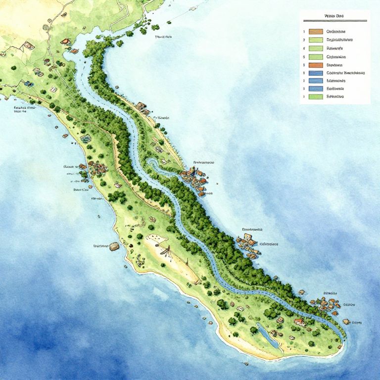
Detailed map of a coastal peninsula with labeled vegetation, water bodies, and settlements, colored in green, yellow, blue, and brown.
Prompt:
Water DnD map illustrating a sprawling river delta merging into a large sea, dotted with fishing villages, dense mangroves, submerged ruins, and navigational hazards like rocks and sandbanks, captured in a watercolor style with soft brush strokes and intricate labeling.
Model:
"Use prompt" will open Create Image tool and will load the prompt
"Remix" will open Create Image tool with this photo set as Reference
Image description:
This is a detailed, colorful topographical map of an island, showcasing various land and water features. The map uses a green-yellow gradient to indicate elevation, with darker green areas representing dense forests and lighter green areas indicating lower land. A winding blue river runs along the center of the island, flanked by lush green vegetation. The coastline is bordered by a blue ocean with white wave textures. The map includes small red markers at various points, likely representing settlements or landmarks. A legend on the right lists colors for different types of terrain, including dense forest, grassland, and water. The island is oriented diagonally, with the top left corner in a lighter, sandy area and the bottom right in darker green forest.
Related keywords:
Image license:
Royalte-free