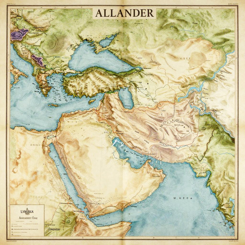
Colored map of the Middle East and North Africa region, highlighting topography, water bodies, and country borders, titled "ALLANDER."
Prompt:
Map of Alexander's empire in an old-world atlas style, detailed coastlines, mountain ranges, rivers, and empire boundaries, hand-drawn aesthetic, soft pastel colors on parchment
Model:
"Use prompt" will open Create Image tool and will load the prompt
"Remix" will open Create Image tool with this photo set as Reference
Image description:
A detailed, colorful map titled "Allander" showing the Middle East and North Africa region. The map uses a topographical style with shades of green, yellow, and brown to depict terrain, and blue for water bodies. Major countries including Egypt, Libya, Saudi Arabia, and Turkey are labeled. The Mediterranean Sea is prominently shown in light blue, while the Red Sea and Persian Gulf are also visible. The map includes topographical contours and a scale bar in the bottom left corner. The title "Allander" is centered at the top, and a legend is placed in the bottom left.
Related keywords:
Image license:
Royalte-free