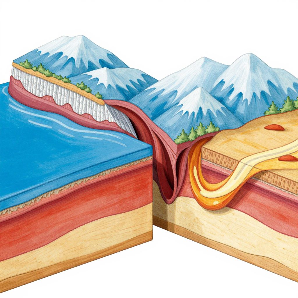
Illustration of a cross-sectional diagram showing mountains, blue water, and forest, with a yellow and red geological fault line.
Prompt:
Convergent plate boundary model showing two tectonic plates colliding with detailed cross-section layers, vibrant colors highlighting oceanic and continental crust, magma chambers, subduction zones, and mountain formation, scientific and educational illustration style.
Model:
"Use prompt" will open Create Image tool and will load the prompt
"Remix" will open Create Image tool with this photo set as Reference
Image description:
This colorful, digital illustration depicts a cross-sectional view of a mountainous landscape. Snow-capped peaks with green tree tops are visible at the top. Below, a red layer represents earth, a yellow layer represents wood, and a blue layer represents water. A red vein-like structure and a yellow, wavy vein-like structure intersect the layers, suggesting geological or biological elements. The vibrant colors and clear, detailed textures give the illustration a scientific, educational feel, with sharp contrasts between the different layers and elements. The background is white, emphasizing the vividness of the landscape and layers.
Related keywords:
Image license:
Royalte-free