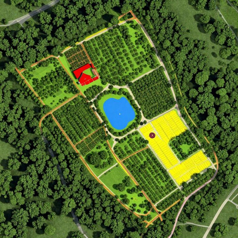
Aerial view of a colorful, detailed park map with a blue pond, red building, yellow field, and surrounded by green trees.
Prompt:
The image depicts a highly detailed and hyperrealistic planning map for a permaculture farm and food forest. The map is color-coded to represent different zones and elements within the farm. Dark green areas indicate trees, while lighter green sections represent forested areas. A vibrant blue pond is situated near the center, surrounded by a mix of green and yellow zones. The map also includes a red area labeled as a house, a yellow section marked as a barn, and a series of walking paths in orange and red, which are aligned with the farm's layout. The overall composition is meticulously organized, with various elements carefully positioned to create a harmonious and functional agricultural landscape. The map is rich in detail, showcasing the intricate planning and design that goes into creating a sustainable and productive permaculture farm.
Model:
"Use prompt" will open Create Image tool and will load the prompt
"Remix" will open Create Image tool with this photo set as Reference
Image description:
This is a digital aerial map-style illustration of a park. The park has a central blue pond surrounded by green trees and grassy areas. To the top left, there's a red-roofed building. Adjacent to the pond, there are two rectangular yellow areas, one of which has a small red circle. The park is bordered by a dense forest with dark green trees, and white paths outline the park's boundaries and sections. The image has a colorful, somewhat cartoonish appearance with distinct, bright colors and clear, simple shapes.
Related keywords:
Image license:
Royalte-free