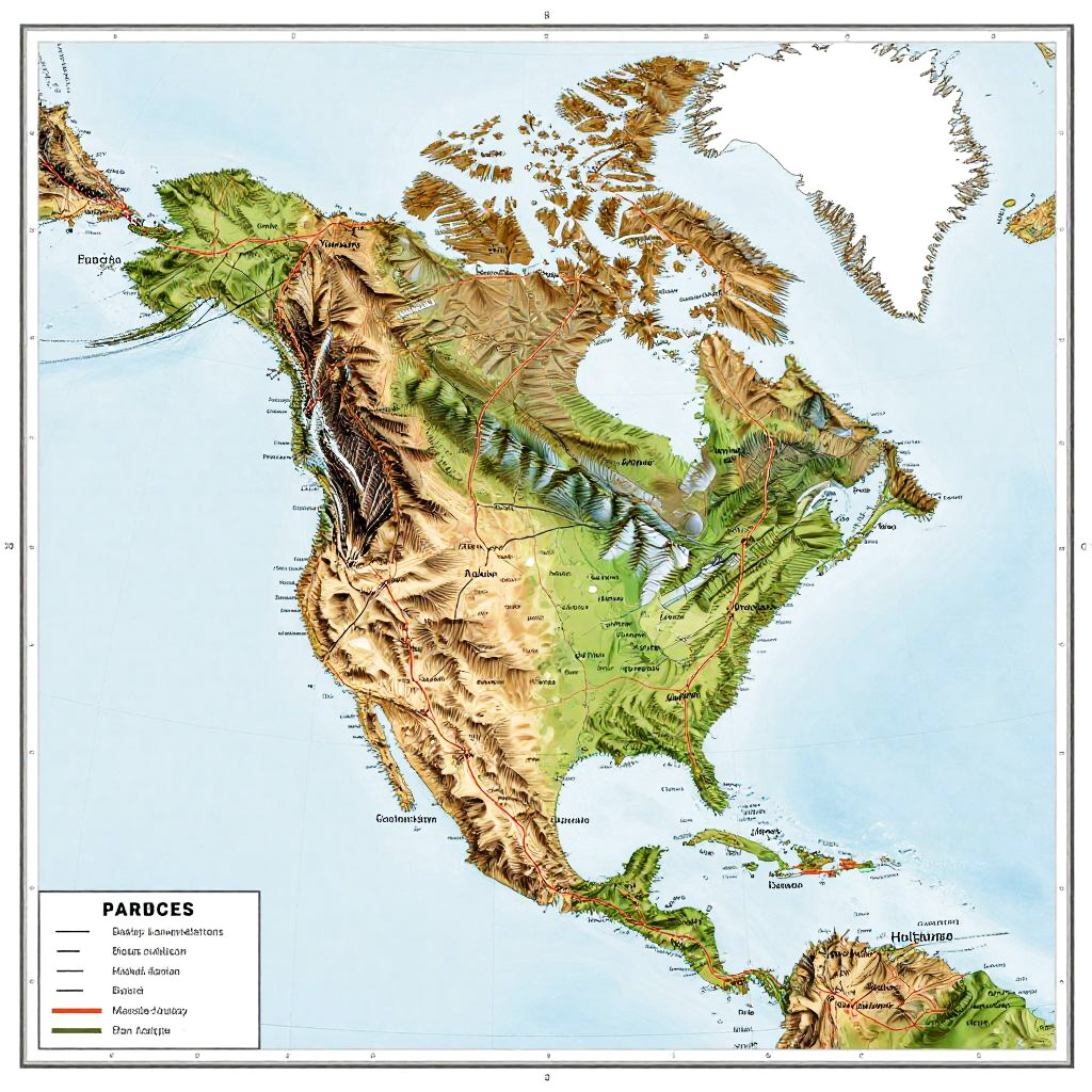
Detailed topographic map of North America, highlighting elevation, terrain, and geographic features with labeled "Parages" legend in the bottom left.
Prompt:
North america map labeled featuring topographical elevation, mountain ranges and major highways, vintage style with earthy tones, clear text labels, realistic texture
Model:
"Use prompt" will open Create Image tool and will load the prompt
"Remix" will open Create Image tool with this photo set as Reference
Image description:
This is a detailed, color-coded topographic map of North and South America, showing elevation and terrain features. The map uses green for lowlands, yellow for mid-elevation areas, and brown for highlands and mountains. The Pacific Ocean surrounds the continent, with the Atlantic Ocean visible on the eastern side. Key mountain ranges, such as the Rockies and Andes, are prominently depicted in brown. The map includes country borders, with a legend in the bottom left corner indicating "Pacific Ocean," "Mid-Ocean Ridge," and "Mountain." The map is digitally rendered with a clear, white border.
Related keywords:
Image license:
Royalte-free