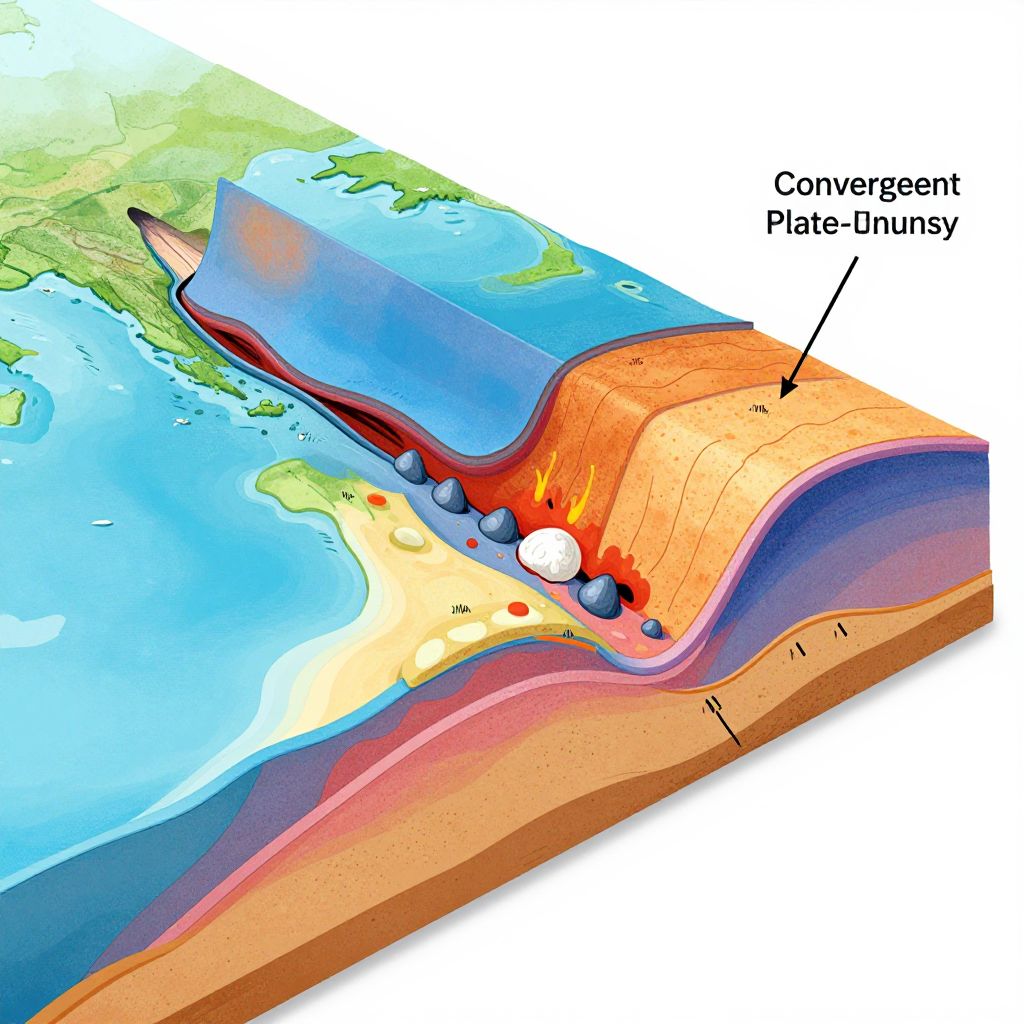
Color-coded cross-sectional map illustrating convergent plate boundary with Earth's continents, ocean, magma chamber, and labeled convergent plate juncture.
Prompt:
Convergent plate boundary model showcasing a dynamic interaction between oceanic and continental plates, colorful cross-sectional visualization of crust, mantle, volcanic eruptions, and earthquake zones, stylized for clarity and educational use with annotations and arrows.
Model:
"Use prompt" will open Create Image tool and will load the prompt
"Remix" will open Create Image tool with this photo set as Reference
Image description:
A colorful, digitally-drawn cross-sectional diagram illustrating the Earth's plate tectonics. The image shows a slice through the Earth, revealing the oceanic and continental plates. The top section displays green landmasses and blue ocean, with a red-orange plate in the middle labeled "Convergent Plate Boundary." The diagram includes black arrows indicating movement, white circles representing magma, and red and blue gradient colors for temperature and pressure. A black label points to the convergent boundary. The bottom section shows a brown crust with a pink-red mantle. The diagram is highly detailed and uses bright, contrasting colors to highlight different geological layers.
Related keywords:
Image license:
Royalte-free